The Painted Book
Universal Atlas of the World – British Isles Map (1900) – Edwardian Elegance in Cartographic Form Print
Universal Atlas of the World – British Isles Map (1900) – Edwardian Elegance in Cartographic Form Print
Couldn't load pickup availability
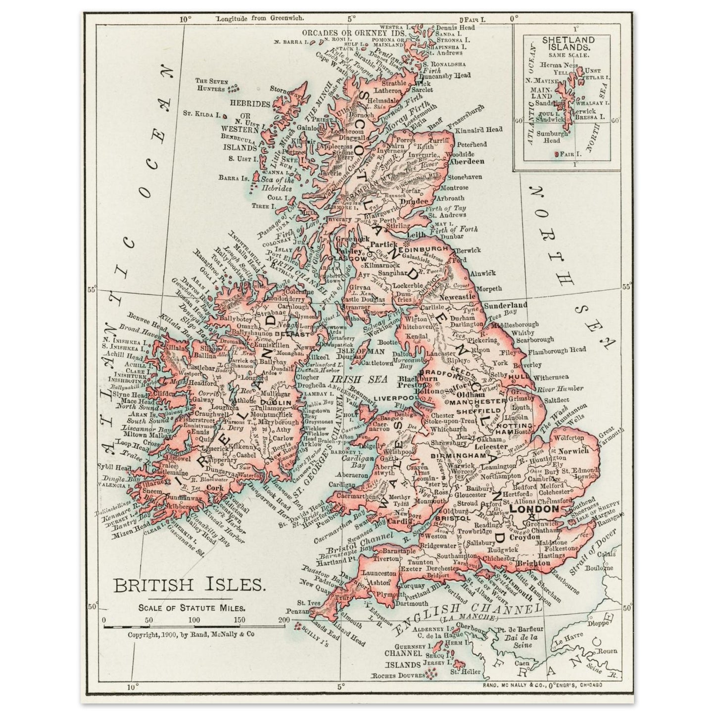
This beautifully detailed map of the British Isles, published in 1900 as part of the Universal Atlas of the World, reflects the precision and artistry of turn-of-the-century cartography. Rendered with elegant typography, shaded relief, and meticulous boundary lines, the map captures Great Britain and Ireland at the height of the Edwardian era—when maps were both practical tools and works of visual refinement.
Perfect for history lovers, Anglophiles, and enthusiasts of vintage décor, this cartographic piece offers more than just geography. It speaks to a time of imperial confidence, scholarly curiosity, and the quiet drama of exploration drawn in ink and scale.
Sized at 8×10", this print is ideal for framing and makes a striking addition to any home, office, or gallery wall.
Printed on heavy 60lb matte photo paper with a soft white finish, this piece offers exceptional detail and ink vibrancy. The acid-free surface ensures longevity, while the 10 mil thickness gives it a luxurious feel worthy of fine art. This is not a print-on-demand product — each print is produced and shipped directly from our studio to ensure the highest quality and care.
Share